


Wide-range LiDAR LA01 model2
Wide-range LiDAR LA01 model2
Required
Couldn't load pickup availability
Notes (Please be sure to check)
Notes (Please be sure to check)
Depending on the product, the customer may be required to provide a battery or smartphone for operation.
Details are listed in the "Notes" section of each product page, so please check them.
For those living in Japan
For those living in Japan
We are sorry, but our shop does not ship to Japan.
If you would like to purchase products from Japan, please contact us here .
Customs duties will be borne by the customer
Customs duties will be borne by the customer
Customs duties may apply.
Please note that customs duties are the responsibility of the customer.


Long-Range LiDAR Capable of Acquiring Color Point Clouds While Walking
The mapry LA01 is the optimal LiDAR device for point cloud management at civil engineering sites and on-ground data acquisition.
You can easily acquire color point cloud data and use it directly as a 3D model.
With a measurement range of up to 200m (details in the specs section), you can safely survey inaccessible objects such as disaster areas from a safe distance.
Its key feature is the ability to measure while walking, and it can also be used for measurement from a fixed position.

Capable of Assigning Coordinates
Using network RTK, you can acquire point cloud data with site coordinates without aerial signals or ground control points (GCPs).
Coordinate conversion to match local TS (Total Station) coordinates is also possible.
Furthermore, as it is equipped with a dual-frequency GNSS receiver, high-precision positioning is possible even without using network RTK.
* When using network RTK, please prepare your own Ntrip account. The availability of surveying via network RTK depends on your country. Please contact your Ntrip service provider.
Easy High-Precision Surveying Without Specialized Knowledge
Connect to your smartphone via Bluetooth, start scanning, and just walk

Easy analysis with the included software
You can use the included analysis software "mapry PC version" for free.
You can perform the following analyses:
- Acquisition of color point clouds (LAS format)
- Extraction of DTM (Digital Terrain Model)
- Creation of slope distribution maps and slope amount maps

Please download the analysis software from the link below.
Video Recording Function
Equipped with a 1.2-megapixel camera, it can record video simultaneously with the point cloud during measurement.
You can check fine details that cannot be captured by the point cloud alone through clear video.

Application Fields
- Infrastructure facilities (bridges, tunnels, coasts, slopes, etc.)
- Buildings, road facilities, etc.
- Plants
- Forests


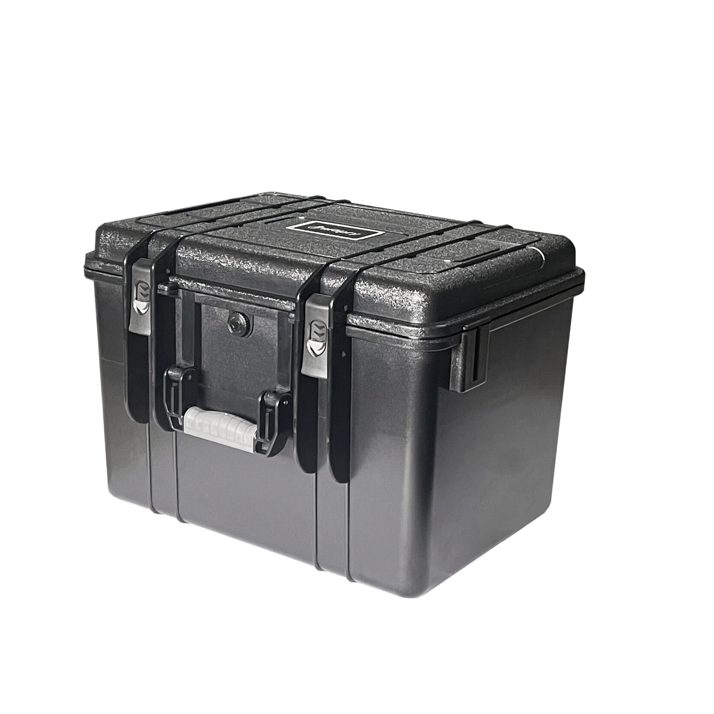
Comes With a Dedicated Case
Comes with a highly durable, airtight dedicated case.
Protects the LiDAR from impacts, rain, and wind.

Notes
Regarding the Use of GNSS
Please use together with the RTK-GNSS "R1".
Regarding the Battery
Due to air transportation, batteries are not included for safety reasons.
Please prepare a battery that meets the following conditions:
- Battery capacity: 20000mAh (Recommended)
- Required ports: USB Type-C × 2
- Output wattage: Capable of outputting 65W or more when using two USB Type-C ports simultaneously
Examples of compatible batteries
- Manufacturer: [ELECOM] Model: [EC-C17LBK]
Regarding Android Devices
A separate Android device is required for operation.
Please prepare your own device.
If you have any questions, please contact us.
Recommended Android devices
- Google Pixel 7a
- Google Pixel 6a
- Google Pixel 5a
- OPPO Reno7 A
- Redmi 12 5G
Regarding the Use of the Application
Requires the use of an Android application.
Please download it from the URL below.
https://play.google.com/store/apps/details?id=net.mapry&hl=ja&gl=US
Software License & Maintenance
[ Pricing ]
- 1st Year: Free of charge
- From 2nd Year Onwards: 17,000 JPY per month (excluding tax)
- Flexible Subscription:
You can easily turn the monthly billing ON or OFF by yourself depending on your usage.
[ Included Services ]
- mapry Forestry (iOS) / mapry GIS (Web) / mapry PC version (Windows)
- Hardware operation apps / Hardware maintenance support (excluding parts costs, etc.)
Specifications
| Measurement Distance | |
|---|---|
| Reflectivity 10% | 190m (0klx), 190m (100klx) |
| Reflectivity 20% | 260m (0klx), 230m (100klx) |
| Reflectivity 80% | 450m (0klx), 230m (100klx) |
| Scanning Section | |
| Scan Speed | 30,000 to 240,000 points/sec |
| Laser Class (IEC 60825-1:2014) | Class 1 |
| Laser | 905nm |
| Measurement Range | 70.0°(H) × 77.2°(V) |
| Angle Accuracy | 0.05°(σ) |
| Close Distance | 0.1m |
| Distance Accuracy | < 2cm |
| 20m(σ) | |
| Camera | |
| Megapixels | 1.2 megapixels |
| Resolution | SXGA |
| Frame Rate | 10fps |
| Format | JPEG |
| Display | |
| Format | Connect to Android device |
| Communications | |
| Communication Range (with Android) | Max 20m |
| Wireless Communication Standards | Bluetooth 5.0 |
| Power Supply | |
| Battery | Mobile battery *Not included |
| Exterior | |
| Dimensions | W 17.0cm × D 21.5cm × H 29.0cm |
| Weight | 3.5kg |
| Operating Environment | |
| Operating Temperature Range | 0 to 50°C |
| Storage Temperature Range | 0 to 30°C |
| Case | |
| Size | W 46.5cm × D 36.5cm × H 32.0cm |
| Weight | 4.8kg |
FAQ
Q. To which countries can the product be shipped?
We can ship the product to the countries where the currencies you can select from the top right of the screen are used. For other regions, please contact us first.
Q. Can mapry conduct a product demo locally?
We normally hold a web meeting (online) at first. We may also conduct a demonstration locally depending on the situation. Please contact us for further details.
Q. How long is the product warranty period?
The warranty period is 6 months.
Q. Is any post-purchase support available?
We will support you via email and online.
Q. How much is the shipping cost?
Please check this page.
Q. Is analysis software required?
You can use the dedicated analysis software "mapry PC version" for free. You can measure DTM (terrain model), cross-sections, and trees.
Q. What PC specs are required for the analysis software?
A PC with Core i7 or higher, 32GB memory or more, and GPU (equivalent to Geforce RTX 4060) is required.
Q. What devices are needed for operation?
A separate Android device is required for operation. Please check here.